
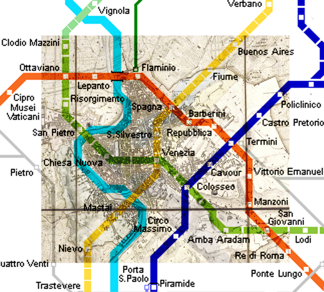
This map shows the expansion of the city of Rome through the development of its Metropolitana system. The metro lines are juxtaposed with the 1829 Census map* of Rome, which was printed showing an accurate plan of the layout of buildings and roads. On this map, it is clear that the grid of the city, though very dense, connects back to the main entrance on Piazza del Popolo. The northern gate to the city was considered the main entrance, from which radiate large diagonal roads connecting the city to important sites, namely religious buildings. Today, the city is accessed through many more axis, using many more methods than those in antiquity. Although walking is still prominent amongst the Romans, other methods of transportation like bikes, cars, buses, motorcycles, and trams are very commonly used.
The most impressive method of transportation used in this vibrant and restless city, is in my opinion the Metro system. Inaugurated with the opening of the line B in 1948, the Metropolitana overcame the many challenges that came with introducing a new development in an ancient city like Rome. Creating an underground transportation system such as this one required much patience, daunting digging, and hoping not to uncover a ruin in the process. Although few lines currently go through the historic center, the subsequent routes added extend to the outskirts of Rome, making the city as a whole more accessible.
*The Census map of 1829 was the first of a series of official plans of the city, the last one being printed in 1866 just before Rome became the capital of a unified Italy. This map was directly derived from the Nolli map changing only one major component, the accuracy of the North.
Leave a Reply
You must be logged in to post a comment.